SKYZ the LIMIT LLC drone logo SKYZ the LIMITThermal drone services 606-331-1681
Portsmouth, Ohio · Thermal drone search

Lost pet? Lost deer? We find them from the sky.

Thermal drone lost pet search and deer recovery across southern Ohio, eastern Kentucky and West Virginia. Call or text for immediate response, day or night.

FAA Part 107 certifiedOhio · Kentucky · West VirginiaFeatured in Commercial UAV News
Our thermal drones
  • DJI Matrice 30T
  • DJI Mavic 3T
  • GDU S220 Pro 1K
Real search · Sissy found in the brush
What we do first

Two searches. One phone number.

Thermal drone lost pet search

Scared pets hide and won't come when called. From the air, a thermal camera picks up a dog or cat's body heat in woods, fields, creek beds and brush piles, then we guide you to the spot.

  • Dogs, cats, ponies and other livestock
  • Best results at night and first light
  • Call as soon as your pet goes missing
Call or text 606-331-1681

Thermal drone deer recovery

Lost the blood trail? We fly the area where your deer ran and find its heat signature, even in thick cover, so you can recover your deer before coyotes or spoilage do.

  • Fast response during deer season
  • We mark the spot and talk you right to it
  • Ohio and Kentucky
Call or text 606-331-1681
In the news

Bringing them home

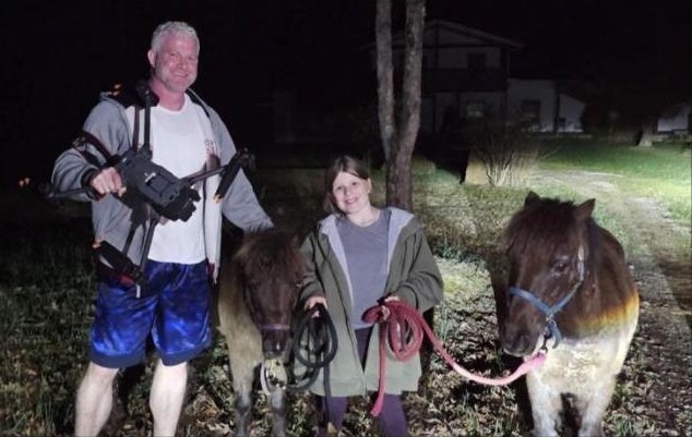
Brandon Akers with his thermal drone and two ponies found after they got loose
Commercial UAV News · June 4, 2026

Skyz the Limit: One pilot's off-the-clock mission to bring pets home

A national drone industry outlet featured our thermal searches for missing pets, loose livestock and wounded deer across the tri-state, and the verified Kentucky thermal pilot map we built to help owners avoid scammers.

The Daily Independent, Ashland, Ky. · March 20, 2026

Eye in the sky: Thermal drones help find lost pets

Brandon and Kayla Akers on night searches that brought home Willow, a dachshund missing in Summit; Lilly, a deaf and blind dog found half a mile from home in a South Webster cornfield; and Cooper, found within a minute and rushed to the animal ER.

Copper the beagleMissing in Lawrence County, Ohio. Found in a stream the same day we were called.Read the Herald-Dispatch story
Meaty the pit bullMissing four days in Culloden, West Virginia. Found within 30 minutes of launching the thermal drone.Watch the search
Ponies, cats and moreDogs, cats and loose livestock, found at night with thermal. Every search is flown by an FAA Part 107 certified pilot.Watch rescue videos
How a search works

From your call to the find

Call or text

Tell us where your pet or deer was last seen and when. A map pin or address helps.

We fly thermal

The drone covers the area from above and spots body heat through cover you can't see into.

We guide you in

We mark the location and talk you to it, so you get there before the animal moves on.

Deer herd analysis

Know every buck on your land

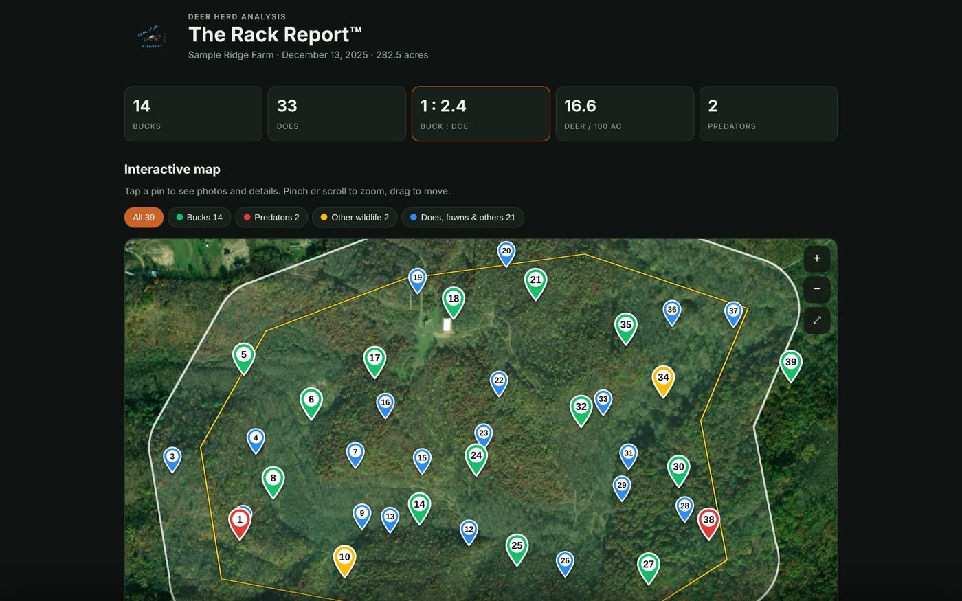
One thermal flight over your whole property, turned into The Rack Report™: a count of bucks, does and predators, your buck-to-doe ratio and deer per 100 acres, with a photo and GPS location for every buck.

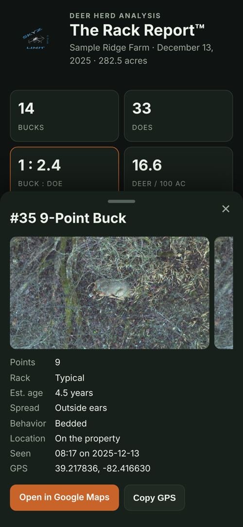
  • Buck cards with points, estimated age and photos
  • Predators and other wildlife marked on the map
  • Interactive map that opens on your phone
  • onX Hunt, Moultrie Mobile and Google Earth files for stand planning
Book a herd analysis
The Rack Report interactive map showing buck, doe and predator pins on a sample property Buck card on a phone: 9-point, about 4.5 years, bedded

Sample report. Property and locations are made up.

More services

Photo, video and mapping

Drone mapping

Aerial maps and orthomosaics of farms, hunting land and job sites.

Real estate & virtual tours

Aerial and ground photos, plus virtual fly-through tours: one smooth drone video that flows from the yard through the front door and room to room, so buyers can walk the whole house online.

Photography

Portraits, events, sports and weddings with mirrorless and drone cameras.

Videography

Promotional and advertising videos, and wedding films.

Service area

Based in Portsmouth, Ohio

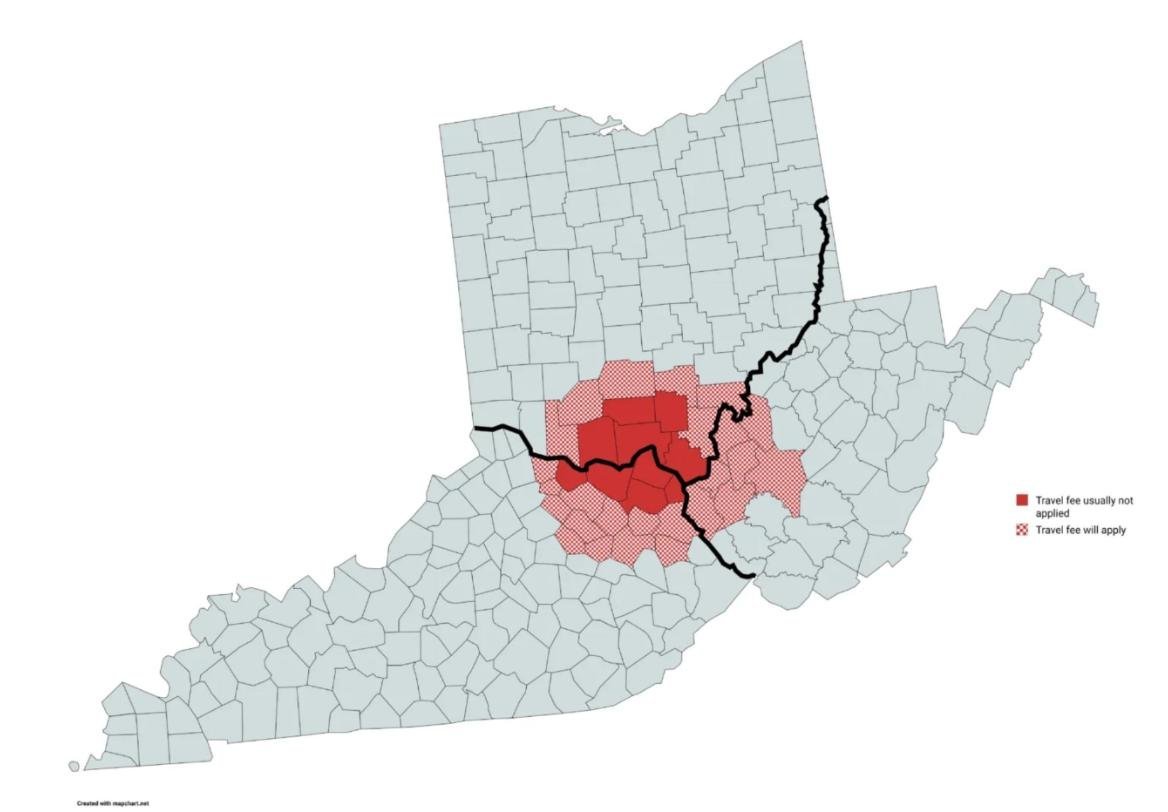
We'll travel as far as needed. Solid red counties usually have no travel fee; a travel fee applies in the shaded counties and beyond.

OhioScioto, Lawrence, Adams, Jackson and Pike counties
KentuckyGreenup, Boyd, Carter, Lewis and Mason counties
West VirginiaLost pet searches in eastern and central West Virginia

Deer recovery covers Ohio and Kentucky. Lost pet searches cover all three states.

SKYZ the LIMIT service area map of southern Ohio, eastern Kentucky and West Virginia counties
GDU Enterprise drone sales

GDU S200 Series drones

GDU S200 Series enterprise drone

The industrial flagship: 720° obstacle avoidance, IP43 weather protection, 45-minute flight time and AI smart recognition. Drones and accessories sold by a working thermal drone pilot.

Shop GDU drones and accessories
For drone pilots

Tally Wild herd analysis software

The program we use to build The Rack Report™, now coming to other thermal drone pilots. Turn one flight into a report landowners pay for. $499 a year with a 14-day free trial, and founding pilots pay $399 a year.

The Rack Report interactive map built with Tally Wild, sample property Visit tallywild.com
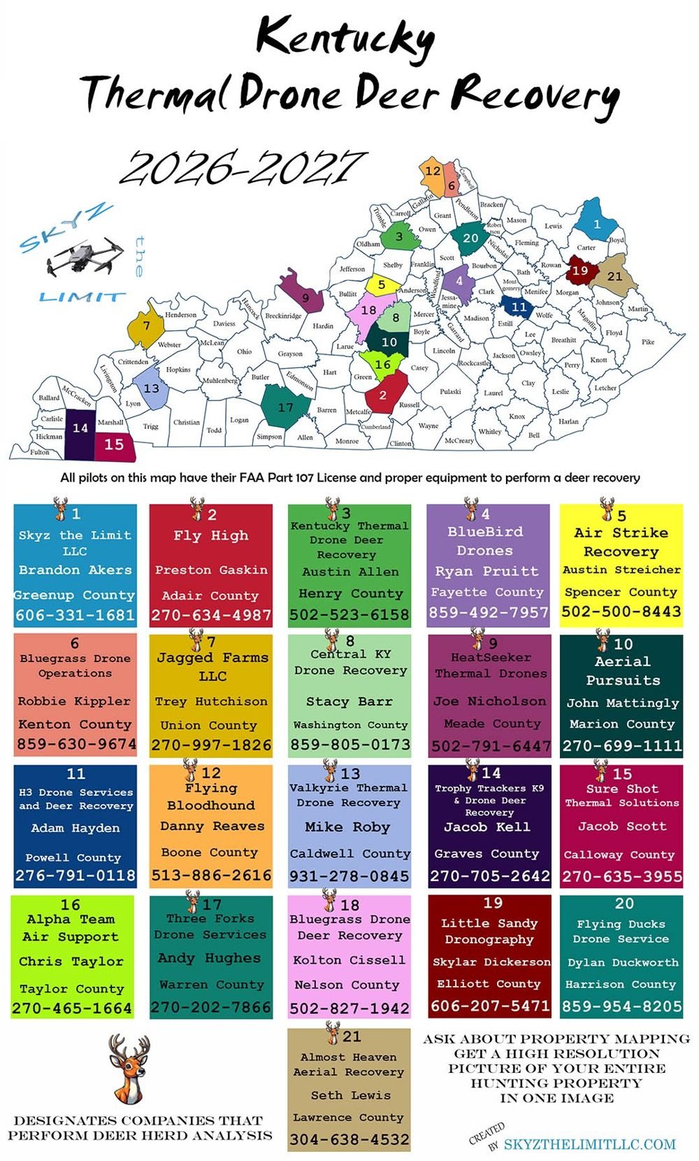
Kentucky Thermal Drone Deer Recovery map 2026-2027 listing verified pilots by county
For drone pilots · Kentucky

Kentucky Thermal Drone Deer Recovery Map

Each hunting season we publish a map of verified thermal drone pilots across Kentucky, so hunters can call a licensed, properly equipped local pilot instead of an unlicensed, under-equipped flyer who doesn’t know what they’re doing, or worse, a scammer in the comments. Every pilot on the 2026–2027 map has an FAA Part 107 license and the right thermal equipment, and pilots who also do deer herd analysis are marked.

Want on the 2027–2028 map?

Message us with your business name, county, phone number, a photo of your thermal drone and your Part 107 certificate. We verify every pilot before the map goes out.
Questions

Before you call

How do I get a thermal drone search for my lost pet?

Call or text 606-331-1681 with where and when your pet was last seen. Thermal searches work best at night and early morning, when an animal's body heat stands out from the ground.

Can a drone find a deer I shot?

Yes. A thermal drone flies over the area where the deer ran and picks up its body heat, even in thick cover. Call or text as soon as you lose the blood trail.

What area do you cover?

Scioto, Lawrence, Adams, Jackson and Pike counties in Ohio and Greenup, Boyd, Carter, Lewis and Mason counties in Kentucky, plus lost pet searches in eastern and central West Virginia. We travel farther with a travel fee.

Are you licensed?

Yes. Every flight is flown by an FAA Part 107 certified pilot.

Don't leave your deer in the woods.

The sooner you call, the better the odds. Pets and deer, day or night.

Call or text 606-331-1681
Call 606-331-1681 Text us